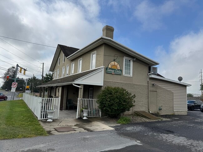
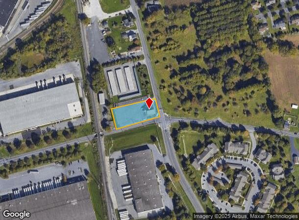
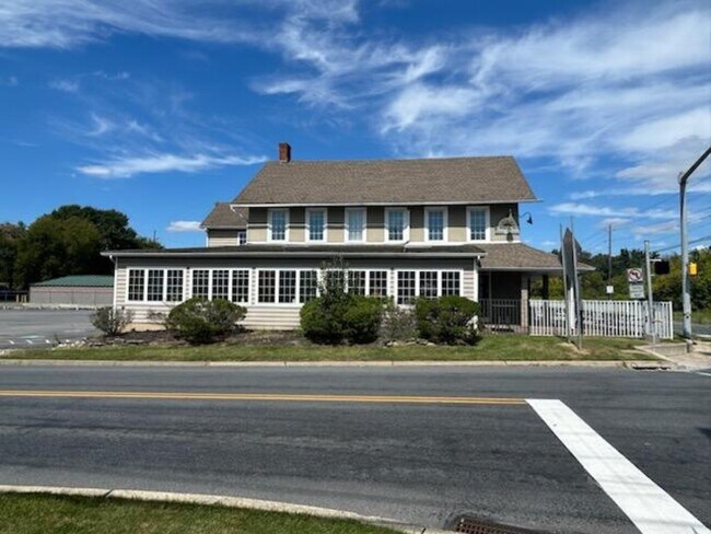
Property Record
6751 Ruppsville Rd, Allentown, PA 18106
Current Lease Availabilities
NEARBY LISTINGS FOR SALE OR LEASE
-
-
View all Allentown listings for lease on LoopNet.com
Property Detail
6751 Ruppsville Rd
546651253125-1
LOTS: 007
Restaurantbuilding
Lehigh
X
Pennsylvania
42011C0250G
7
2025
0.78 AC
2025
Lehigh Valley
006204
Philadelphia
5,012 SF
Allentown-Bethlehem-Easton, PA-NJ
DEMOGRAPHICS near 6751 Ruppsville Rd
1 Mile
3 Mile
5 Mile
2024 Total Population
3,961
36,639
95,920
2029 Population
4,098
37,932
99,020
Pop Growth 2024-2029
+ 3.46%
+ 3.53%
+ 3.23%
Average Age
39
42
42
2024 Total Households
1,389
13,858
36,243
HH Growth 2024-2029
+ 3.67%
+ 3.69%
+ 3.36%
Median Household Inc
$124,761
$113,085
$113,682
Avg Household Size
2.80
2.60
2.60
2024 Avg HH Vehicles
2.00
2.00
2.00
Median Home Value
$436,111
$429,893
$422,765
Median Year Built
1996
1991
1987
Nearby Places
- Restaurants
- Banks
- Shops
- Fitness
- Groceries
PUBLIC TRANSPORTATION
AIRPORT
Lehigh Valley International
DRIVE
WALK
Distance
Lehigh Valley International
20 min
11.7 mi
Freight Ports
Port of Philadelphia
DRIVE
WALK
Distance
Port of Philadelphia
78 min
60.0 mi
Nearby Properties
Address
Land Use
TOTAL SIZE
Lot Size
Zoning
Address
Land Use
TOTAL SIZE
Lot Size
Zoning
474,892 SF
33.35 AC
L1-L
Address
Land Use
TOTAL SIZE
Lot Size
Zoning
1,155,164 SF
101.05 AC
L1
Address
Land Use
TOTAL SIZE
Lot Size
Zoning
1,042,665 SF
86 AC
LI
Address
Land Use
TOTAL SIZE
Lot Size
Zoning
600,000 SF
72.02 AC
L1
Address
Land Use
TOTAL SIZE
Lot Size
Zoning
58,613 SF
26.22 AC
HC-1
Address
Land Use
TOTAL SIZE
Lot Size
Zoning
1,192,380 SF
83.59 AC
LI
Address
Land Use
TOTAL SIZE
Lot Size
Zoning
685,920 SF
83.33 AC
LI
Address
Land Use
TOTAL SIZE
Lot Size
Zoning
999,600 SF
67.99 AC
LI
Address
Land Use
TOTAL SIZE
Lot Size
Zoning
12,545 SF
84.20 AC
LI
Address
Land Use
TOTAL SIZE
Lot Size
Zoning
225,102 SF
20 AC
HC
Address
Land Use
TOTAL SIZE
Lot Size
Zoning
28,911 SF
35.36 AC
GI
Address
Land Use
TOTAL SIZE
Lot Size
Zoning
4,990 SF
39.62 AC
R5
Address
Land Use
TOTAL SIZE
Lot Size
Zoning
920,400 SF
65.34 AC
LI
Address
Land Use
TOTAL SIZE
Lot Size
Zoning
789,551 SF
52.39 AC
LI
Address
Land Use
TOTAL SIZE
Lot Size
Zoning
822,162 SF
50.12 AC
LI
Address
Land Use
TOTAL SIZE
Lot Size
Zoning
730,080 SF
44.34 AC
Address
Land Use
TOTAL SIZE
Lot Size
Zoning
730,080 SF
44.96 AC
Address
Land Use
TOTAL SIZE
Lot Size
Zoning
640,041 SF
155.76 AC
IC-1
Address
Land Use
TOTAL SIZE
Lot Size
Zoning
794,880 SF
45.63 AC
LI
Address
Land Use
TOTAL SIZE
Lot Size
Zoning
573,344 SF
38.61 AC
LI
Address
Land Use
TOTAL SIZE
Lot Size
Zoning
480,000 SF
27.94 AC
LI
Address
Land Use
TOTAL SIZE
Lot Size
Zoning
610,647 SF
46.50 AC
LI
Address
Land Use
TOTAL SIZE
Lot Size
Zoning
19,055 SF
194.07 AC
LI
Address
Land Use
TOTAL SIZE
Lot Size
Zoning
4,948 SF
51.05 AC
R3
Address
Land Use
TOTAL SIZE
Lot Size
Zoning
725,760 SF
50.25 AC
LI
Address
Land Use
TOTAL SIZE
Lot Size
Zoning
4,037 SF
30.51 AC
R5
Address
Land Use
TOTAL SIZE
Lot Size
Zoning
91,706 SF
17.27 AC
HC-I
Address
Land Use
TOTAL SIZE
Lot Size
Zoning
808,418 SF
65.50 AC
LI
Address
Land Use
TOTAL SIZE
Lot Size
Zoning
607,320 SF
53.44 AC
LI
Address
Land Use
TOTAL SIZE
Lot Size
Zoning
205,985 SF
28.37 AC
C
The World's #1 Commercial Real Estate Marketplace
Connect with us
© 2025 CoStar Group
The information above has been obtained from sources believed reliable. While we do not doubt its accuracy we have not verified it and make no guarantee, warranty or representation about it. It is your responsibility to independently confirm its accuracy and completeness. Any projections, opinions, assumptions, or estimates used are for example only and do not represent the current or future performance of the property. The value of this transaction to you depends on tax and other factors which should be evaluated by your tax, financial, and legal advisors. You and your advisors should conduct a careful, independent investigation of the property to determine to your satisfaction the suitability of the property for your needs.